
Fichier:SouthAmericaLocation.svg

Taille de cet aperçu PNG pour ce fichier SVG : 463 × 236 pixels. Autres résolutions : 320 × 163 pixels | 640 × 326 pixels | 1 024 × 522 pixels | 1 280 × 652 pixels | 2 560 × 1 305 pixels.
Fichier d’origine (Fichier SVG, nominalement de 463 × 236 pixels, taille : 290 kio)
Ce fichier provient de Wikimedia Commons.
Les informations le concernant sont affichées dans cette page de description qui est copiée ci-dessous.
Commons est un serveur de fichiers sous licence libre. Vous pouvez aider (procédure). |

Description
| Description |
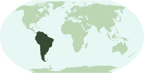
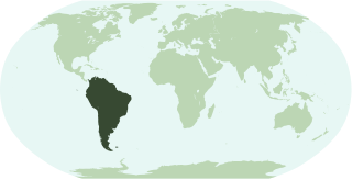
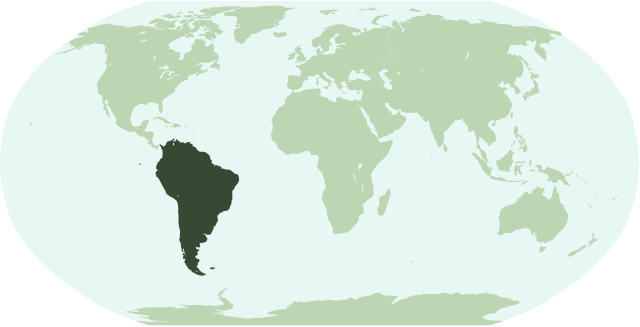
English: Map showing the location of the continent of South America.
Français : Une carte pour démontrer la location du continent de l'Amérique du Sud.
Interlingua: Un Mapa monstrante le location del continente de America del Sud. |
| Date | |
| Source | Travail personnel |
| Auteur | Notscott |
Conditions d’utilisation
| Moi, propriétaire des droits d’auteur sur cette œuvre, la place dans le domaine public. Ceci s'applique dans le monde entier. Dans certains pays, ceci peut ne pas être possible ; dans ce cas : J’accorde à toute personne le droit d’utiliser cette œuvre dans n’importe quel but, sans aucune condition, sauf celles requises par la loi. |
Historique du fichier
Cliquer sur une date et heure pour voir le fichier tel qu'il était à ce moment-là.
| Date et heure | Vignette | Dimensions | Utilisateur | Commentaire | |
|---|---|---|---|---|---|
| actuel | 15 janvier 2007 à 01:49 | | 463 × 236 (290 kio) | Notscott | |
| 15 janvier 2007 à 01:43 |  | 463 × 236 (290 kio) | Notscott | == Summary == {{en|Map showing the location of the continent of South America.}} {{fr|Une carte pour démontrer la location du continent de l'Amérique du Sud.}} {{ia|Un Mapa monstrante le location del continente de America del Sud.}} == Licensing == {{P |
Utilisation du fichier
Aucune page n’utilise ce fichier.
Usage global du fichier
Les autres wikis suivants utilisent ce fichier :
- Utilisation sur arc.wikipedia.org
- Utilisation sur arz.wikipedia.org
- برازيل
- امريكا الجنوبيه
- ارجنتين
- سورينام
- بيرو
- كولومبيا
- جزر فوكلاند
- جيانا الفرنساويه
- قالب:امريكا الجنوبيه
- قالب:امريكا الجنوبية/شرح
- قالب:شرح استعمال قوالب القارات
- تشيلى
- اروبا
- اكوادور
- جزر جورجيا و ساندويتش الجنوبيه
- ترينيداد و توباجو
- فالبارايسو
- نشيد الاكوادور الوطنى
- نشيد السلفادور الوطنى
- نشيد باراجواى الوطنى
- نشيد جواتيمالا الوطنى
- قالب:اناشيد دول امريكا الجنوبيه
- قالب:جامعات امريكا الجنوبيه
- جزر الانتيل الهولنديه
- Utilisation sur bi.wikipedia.org
- Utilisation sur bpy.wikipedia.org
- Utilisation sur ckb.wikipedia.org
- Utilisation sur en.wikipedia.org
- Utilisation sur es.wikipedia.org
Voir davantage sur l’utilisation globale de ce fichier.