
Fichier:Fiji detail.jpg

Taille de cet aperçu : 589 × 600 pixels. Autres résolutions : 236 × 240 pixels | 600 × 611 pixels.
Fichier d’origine (600 × 611 pixels, taille du fichier : 50 kio, type MIME : image/jpeg)
Ce fichier provient de Wikimedia Commons.
Les informations le concernant sont affichées dans cette page de description qui est copiée ci-dessous.
Commons est un serveur de fichiers sous licence libre. Vous pouvez aider (procédure). |


|
This map has been uploaded by Electionworld from en.wikipedia.org to enable the |
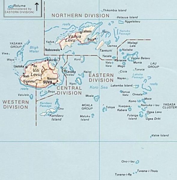
PNG map of Fiji from CIA World Factbook.
Cette image est dans le domaine public parce que son contenu provient du World Factbook, édité par la Central Intelligence Agency des États-Unis d’Amérique.
|
 |
Historique du fichier
Cliquer sur une date et heure pour voir le fichier tel qu'il était à ce moment-là.
| Date et heure | Vignette | Dimensions | Utilisateur | Commentaire | |
|---|---|---|---|---|---|
| actuel | 30 juin 2010 à 12:51 | | 600 × 611 (50 kio) | Telim tor | exchanged positions of Tuvana-i-Ra and Tuvana-i-Tholo (i-Ra is the southwestern one, see also [http://www.un.org/Depts/Cartographic/map/profile/Fiji.pdf this map] (PDF) |
| 27 novembre 2006 à 19:45 |  | 600 × 611 (48 kio) | Electionworld | {{ew|en|Pascal}} PNG map of Fiji from CIA World Factbook. {{PD-USGov-CIA-WF}} Category:Maps of Fiji |
Utilisation du fichier
Aucune page n’utilise ce fichier.
Usage global du fichier
Les autres wikis suivants utilisent ce fichier :
- Utilisation sur avk.wikipedia.org
- Utilisation sur az.wikipedia.org
- Utilisation sur be.wikipedia.org
- Utilisation sur cs.wikipedia.org
- Utilisation sur de.wikipedia.org
- Utilisation sur en.wikipedia.org
- Utilisation sur es.wikinews.org
- Utilisation sur io.wikipedia.org
- Utilisation sur ka.wikipedia.org
- Utilisation sur pl.wikipedia.org
- Utilisation sur ru.wikipedia.org
- Utilisation sur tr.wikipedia.org
- Utilisation sur uk.wikipedia.org
- Utilisation sur www.wikidata.org