
Fichier:Relief Map of Czech Republic.png

Taille de cet aperçu : 800 × 486 pixels. Autres résolutions : 320 × 195 pixels | 640 × 389 pixels | 1 000 × 608 pixels.
Fichier d’origine (1 000 × 608 pixels, taille du fichier : 866 kio, type MIME : image/png)
Ce fichier provient de Wikimedia Commons.
Les informations le concernant sont affichées dans cette page de description qui est copiée ci-dessous.
Commons est un serveur de fichiers sous licence libre. Vous pouvez aider (procédure). |

Description
| Description |
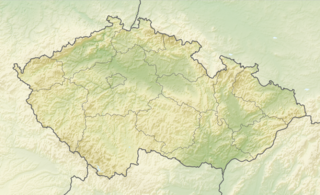
English: Relief map of the Czech Republic
Equirectangular projection, N/S stretching 150 %. Geographic limits of the map:
|
| Date | |
| Source |
|
| Auteur | derivative work Виктор_В |
Conditions d’utilisation
Ce fichier est disponible selon les termes de la licence Creative Commons Attribution – Partage dans les Mêmes Conditions 3.0 (non transposée).
- Vous êtes libre :
- de partager – de copier, distribuer et transmettre cette œuvre
- d’adapter – de modifier cette œuvre
- Sous les conditions suivantes :
- paternité – Vous devez donner les informations appropriées concernant l'auteur, fournir un lien vers la licence et indiquer si des modifications ont été faites. Vous pouvez faire cela par tout moyen raisonnable, mais en aucune façon suggérant que l’auteur vous soutient ou approuve l’utilisation que vous en faites.
- partage à l’identique – Si vous modifiez, transformez, ou vous basez sur cette œuvre, vous devez distribuer votre contribution sous la même licence ou une licence compatible avec celle de l’original.
Historique du fichier
Cliquer sur une date et heure pour voir le fichier tel qu'il était à ce moment-là.
| Date et heure | Vignette | Dimensions | Utilisateur | Commentaire | |
|---|---|---|---|---|---|
| actuel | 11 janvier 2021 à 08:37 | | 1 000 × 608 (866 kio) | ThecentreCZ | Reverted to version as of 11:53, 28 August 2010 (UTC) V Ústavním pořádku České republiky nemají zemské hranice žádné ukotvení a jsou jen přežitkem |
| 10 janvier 2021 à 22:48 |  | 1 000 × 608 (780 kio) | Osidor | přidány zemské hranice (důvod: na mapě jsou užitečné nejméně stejně jako ty krajské [spíše však více]) | |
| 28 août 2010 à 11:53 |  | 1 000 × 608 (866 kio) | Виктор В | == {{int:filedesc}} == {{Information |Description={{en|Location map of the Czech Republic}} Equirectangular projection, N/S stretching 150 %. Geographic limits of the map: * N: 51.3° N * S: 48.3° N * W: 11.8° E * O: 19.2° |
Utilisation du fichier
Aucune page n’utilise ce fichier.
Usage global du fichier
Les autres wikis suivants utilisent ce fichier :
- Utilisation sur als.wikipedia.org
- Utilisation sur arz.wikipedia.org
- Utilisation sur ast.wikipedia.org
- Utilisation sur azb.wikipedia.org
- Utilisation sur az.wikipedia.org
- Utilisation sur ba.wikipedia.org
- Utilisation sur be-tarask.wikipedia.org
- Utilisation sur be.wikipedia.org
- Utilisation sur bg.wikipedia.org
Voir davantage sur l’utilisation globale de ce fichier.