
Fichier:Mars Géolocalisation.jpg
Taille de cet aperçu : 800 × 400 pixels. Autres résolutions : 320 × 160 pixels | 640 × 320 pixels | 1 024 × 512 pixels | 1 280 × 640 pixels | 2 048 × 1 024 pixels.
Fichier d’origine (2 048 × 1 024 pixels, taille du fichier : 1,55 Mio, type MIME : image/jpeg)
Ce fichier provient de Wikimedia Commons.
Les informations le concernant sont affichées dans cette page de description qui est copiée ci-dessous.
Commons est un serveur de fichiers sous licence libre. Vous pouvez aider (procédure). |

Description
| Description |
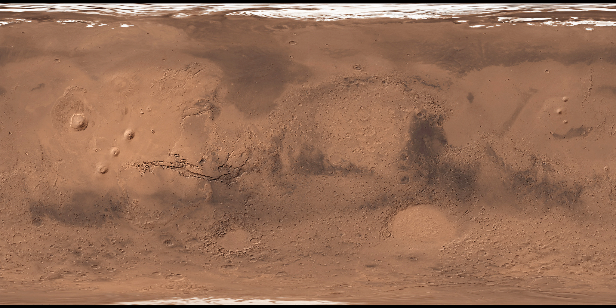
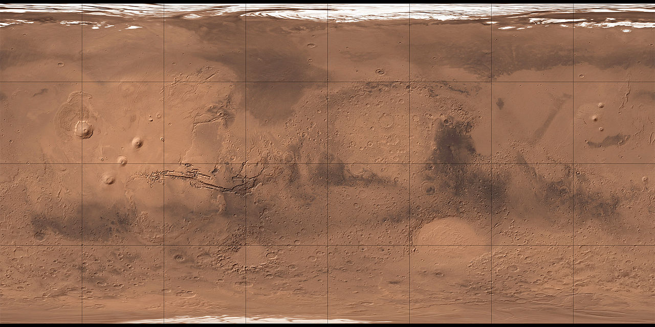
Français : Carte de Mars reconstituée à partir des mesures de Mars Global Surveyor (MOLA) et des observations de Viking. |
| Date | 2 août 2008 (date de téléversement) |
| Source | MOLA Shaded Relief & Viking. |
| Auteur | NASA, USGS et Who killed Bambi ? pour les retouches. |
| Autres versions |

Conditions d’utilisation
| Ce fichier provient de la NASA. Sauf exception, les documents créés par la NASA ne sont pas soumis à copyright. Pour plus d'informations, voir la politique de copyright de la NASA. | ||
 |
Attention :
|
Cette image est placée dans le domaine public parce qu'elle contient des éléments issus de l'United States Geological Survey, une agence du Département de l'Intérieur des États-Unis. Pour plus d'information, consultez la politique officielle de copyright de l'USGS (en anglais)
|
| Annotations | Cette image est annotée : Voir les annotations sur Wikimedia Commons |
Historique du fichier
Cliquer sur une date et heure pour voir le fichier tel qu'il était à ce moment-là.
| Date et heure | Vignette | Dimensions | Utilisateur | Commentaire | |
|---|---|---|---|---|---|
| actuel | 2 août 2008 à 11:34 | | 2 048 × 1 024 (1,55 Mio) | Who killed Bambi ? | {{Information |Description= |Source= |Date= |Author= |Permission= |other_versions= }} |
| 27 juillet 2008 à 13:07 |  | 2 048 × 1 024 (1,96 Mio) | Who killed Bambi ? | {{Information |Description={{fr|1=Carte de Mars reconstituée à partir des observations de Viking}} |Source=ftp://ftpflag.wr.usgs.gov/dist/pigpen/mars/usgs/mdim1_color/ |Author=USGS |Date=03/04/2004 |Permission= |other_versions= }} {{ImageUpload|full}} |
Utilisation du fichier
Les 2 pages suivantes utilisent ce fichier :
Usage global du fichier
Les autres wikis suivants utilisent ce fichier :
- Utilisation sur ar.wikipedia.org
- أرض عشتار
- ندبة هيبيس
- وادي النيل (المريخ)
- فاستيتاس بورياليس
- أريس فاليس
- جبل أوليمبوس مونز
- قمة اسكريوس
- جبل ماكسويل
- فوهة غيل
- فكتوريا (فوهة)
- جبل الريح (المريخ)
- جبل غولا
- جبل أبيونا
- جبل أنالا
- جبل ساباس
- جبل ثيا
- جبل ماعت
- جبل أوشاس
- وجه على المريخ
- أرض العرب (المريخ)
- قالب:خريطة مواقع المريخ
- منطقة ألفا
- منطقة بيتا
- بافونيس مونس
- وادي مارينر
- هضبة سوريا (المريخ)
- الحوض القطبي الشمالي
- هيكاتيس ثولوس (المريخ)
- يوتوبيا بلانيشيا
- Utilisation sur az.wikipedia.org
- Utilisation sur ba.wikipedia.org
- Utilisation sur be.wikipedia.org
- Utilisation sur bg.wikipedia.org
- Utilisation sur ca.wikipedia.org
Voir davantage sur l’utilisation globale de ce fichier.