
Fichier:CHL orthographic.svg

Taille de cet aperçu PNG pour ce fichier SVG : 551 × 551 pixels. Autres résolutions : 240 × 240 pixels | 480 × 480 pixels | 768 × 768 pixels | 1 024 × 1 024 pixels | 2 048 × 2 048 pixels.
Fichier d’origine (Fichier SVG, nominalement de 551 × 551 pixels, taille : 1 012 kio)
Ce fichier provient de Wikimedia Commons.
Les informations le concernant sont affichées dans cette page de description qui est copiée ci-dessous.
Commons est un serveur de fichiers sous licence libre. Vous pouvez aider (procédure). |

Description
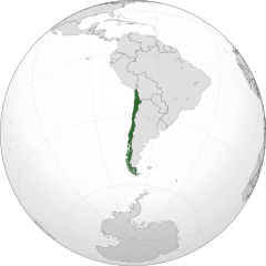
| Description |
Čeština: Ortografická mapa Chile zaměřená na 37° severní šířky, 71° západní délky.
Oficiální území.
Nárokovaná území. English: A map of the hemisphere centred on -71, -37, using an orthographic projection, created using gringer's Perl script with Natural Earth Data (1:50000 resolution, simplified to 0.25px).
Chile is highlighted in green. Official territory.
Claimed territories. |
| Date | |
| Source | Travail personnel with Natural Earth Data |
| Auteur | Addicted04 |
| SVG information |
.svg)
.svg)
.svg)
.svg)
.svg)
.svg)
.svg)
.svg)
.svg)
.svg)
.svg)
.svg)
.svg)
.svg)
.svg)
.svg)
.svg)
.svg)
.svg)
.svg)
.svg)
.svg)
.svg)
.svg)
.svg)
.svg)
.svg)
.svg)
.svg)
.svg)
.svg)
.svg)
.svg)
.svg)
.svg)
.svg)
.svg)
.svg)
.svg)
.svg)
.svg)
.svg)
.svg)
.svg)
.svg)
.svg)
.svg)
.svg)
.svg)
.svg)
.svg)
.svg)
.svg)
.svg)
.svg)
.svg)
.svg)
.svg)
.svg)
.svg)
.svg)
.svg)
.svg)
.svg)
.svg)
.svg)
.svg)
.svg)
.svg)
.svg)
.svg)
.svg)
.svg)
.svg)

.svg)

.svg)

.svg)
.svg)
.svg)
.svg)
.svg)
.svg)
.svg)


.svg)
.svg)
.svg)
.svg)
.svg)
.svg)
.svg)

.svg)
.svg)
.svg)
.svg)
.svg)
.svg)
.svg)
.svg)
.svg)

.svg)
.svg)
.svg)
.svg)
.svg)
.svg)
.svg)
_without_national_boundaries.svg)
.svg)
.svg)
.svg)
.svg)
.svg)
.svg)

.svg)
.svg)
.png)
.svg)
.svg)
.svg)
.svg)

.svg)
.svg)
.svg)
.svg)
.svg)
.svg)
.svg)
.svg)
.svg)
.svg)
.svg)

.svg)
.svg)
.svg)
.svg)
.svg)
.svg)
.svg)
.svg)
.svg)

.svg)
.svg)

.svg)
.svg)
.svg)
.svg)
.svg)
.svg)
.svg)
.svg)
.svg)
.svg)
.svg)
.svg)
.svg)
.svg)
.svg)
.svg)
.svg)
.svg)
.svg)
.svg)
.svg)
.svg)
.svg)
.svg)
.svg)
.svg)
.svg)
_-_Crimea_disputed.svg)
.svg)
.svg)
.svg)
.svg)
.svg)
.svg)
.svg)
.svg)
.svg)
.svg)
.svg)
_political.svg)
.svg)
.svg)
.svg)
.svg)
_-_Crimea_disputed_-_no_borders.svg)
.svg)
.svg)
.svg)
.svg)
.svg)
.svg)
.svg)
.svg)
.svg)
.svg)
.svg)

.svg)
.svg)
.svg)

.png)
.svg)
.svg)
.svg)
.svg)
.svg)
.svg)
.svg)
.svg)
.svg)
.svg)
.svg)
.svg)
.svg)
.svg)
.svg)
.svg)
.svg)
.svg)
.svg)
.svg)
.svg)
.svg)
.svg)
.svg)
.svg)
.svg)
.svg)
.svg)
.svg)
.svg)
.svg)
.svg)
.svg)
.svg)
.png)
.svg)
.svg)
.svg)
_(orthographic_projection).png)
| Orthographic projections maps created by Ssolbergj |
|---|
| Orthographic projections maps created by Ssolbergj: |
.svg)
.svg)
Conditions d’utilisation
| Moi, propriétaire des droits d’auteur sur cette œuvre, la place dans le domaine public. Ceci s'applique dans le monde entier. Dans certains pays, ceci peut ne pas être possible ; dans ce cas : J’accorde à toute personne le droit d’utiliser cette œuvre dans n’importe quel but, sans aucune condition, sauf celles requises par la loi. |
Historique du fichier
Cliquer sur une date et heure pour voir le fichier tel qu'il était à ce moment-là.
| Date et heure | Vignette | Dimensions | Utilisateur | Commentaire | |
|---|---|---|---|---|---|
| actuel | 19 janvier 2014 à 23:14 | | 551 × 551 (1 012 kio) | Addicted04 | New map, Chile ''de facto'' only, for claims see File:CHL orthographic (+all claims).svg |
| 12 septembre 2012 à 20:21 |  | 550 × 550 (496 kio) | Palosirkka | Scrubbed with http://codedread.com/scour/ | |
| 22 octobre 2011 à 22:56 |  | 550 × 550 (707 kio) | Addicted04 | claimed color | |
| 22 octobre 2011 à 22:08 |  | 550 × 550 (707 kio) | Addicted04 | claimed color | |
| 14 octobre 2011 à 20:31 |  | 550 × 550 (707 kio) | Addicted04 | New map | |
| 6 novembre 2010 à 01:12 |  | 550 × 550 (642 kio) | Addicted04 | {{Information |Description={{en|1=Orthographic map of Chile}} {{es|1=Mapa ortográfico de Chile}} |Source={{own}} |Author=Addicted04 |Date=2010- |
.svg)
Utilisation du fichier
Les 2 pages suivantes utilisent ce fichier :
Usage global du fichier
Les autres wikis suivants utilisent ce fichier :
- Utilisation sur af.wikipedia.org
- Utilisation sur arc.wikipedia.org
- Utilisation sur ar.wikipedia.org
- الحكم العسكري في تشيلي (1973-90)
- مستخدم:جار الله/قائمة صور مقالات العلاقات الثنائية
- العلاقات الأمريكية التشيلية
- العلاقات الأنغولية التشيلية
- العلاقات التشيلية الكورية الجنوبية
- العلاقات الإريترية التشيلية
- العلاقات التشيلية السويسرية
- العلاقات الألمانية التشيلية
- العلاقات التشيلية الليختنشتانية
- العلاقات البوليفية التشيلية
- العلاقات التشيلية الموزمبيقية
- العلاقات الألبانية التشيلية
- العلاقات البلجيكية التشيلية
- العلاقات الإثيوبية التشيلية
- العلاقات التشيلية البيلاروسية
- العلاقات التشيلية الطاجيكستانية
- العلاقات التشيلية الروسية
- العلاقات التشيلية الرومانية
- العلاقات التشيلية الغامبية
- العلاقات التشيلية القبرصية
- العلاقات التشيلية السيراليونية
- العلاقات التشيلية النيبالية
- العلاقات التشيلية الليبيرية
- العلاقات التشيكية التشيلية
- العلاقات التشيلية الميانمارية
- العلاقات السعودية التشيلية
- العلاقات التشيلية الكندية
- العلاقات التشيلية الزيمبابوية
- العلاقات الإسرائيلية التشيلية
- العلاقات البالاوية التشيلية
- العلاقات التشيلية المالية
- العلاقات التشيلية النيجيرية
- العلاقات اليمنية التشيلية
- العلاقات التشيلية الفانواتية
- العلاقات الغابونية التشيلية
- العلاقات البنمية التشيلية
- العلاقات التشيلية الكوبية
- العلاقات التشيلية الجورجية
- العلاقات التشيلية التونسية
- العلاقات التشيلية الكورية الشمالية
- العلاقات الهندية التشيلية
- العلاقات اليابانية التشيلية
- العلاقات الإيطالية التشيلية
- العلاقات التشيلية الناوروية
- العلاقات الأسترالية التشيلية
- العلاقات التشيلية الزامبية
- العلاقات التشيلية الفيجية
- العلاقات التشيلية المارشالية
Voir davantage sur l’utilisation globale de ce fichier.