
Fichier:Quebec-map.png
Pas de plus haute résolution disponible.
Quebec-map.png (280 × 230 pixels, taille du fichier : 15 kio, type MIME : image/png)
Ce fichier provient de Wikimedia Commons.
Les informations le concernant sont affichées dans cette page de description qui est copiée ci-dessous.
Commons est un serveur de fichiers sous licence libre. Vous pouvez aider (procédure). |


|
Une version vectorielle de cette image existe, dans le format « SVG ». Si elle n’est pas inférieure, elle devrait être utilisée à la place de la présente version pour des affichages en plus grandes dimensions ou nécessitant une meilleure résolution.
File:Quebec-map.png → File:Québec, Canada.svg
Pour plus d’informations sur les images vectorielles, consultez la page de transition de Commons vers le format SVG. Voir aussi les informations à propos de la manière dont le logiciel MediaWiki gère les images au format SVG. |
 |
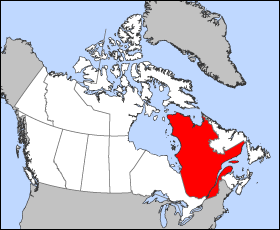
Map of Quebec (Canada)
Projection: Lambert azimuthal equal-area
Geospatial data from: The Atlas of Canada, The National Atlas of the United States and U.S. Geological Survey
Cartographer: John Fowler
| Moi, propriétaire des droits d’auteur sur cette œuvre, la place dans le domaine public. Ceci s'applique dans le monde entier. Dans certains pays, ceci peut ne pas être possible ; dans ce cas : J’accorde à toute personne le droit d’utiliser cette œuvre dans n’importe quel but, sans aucune condition, sauf celles requises par la loi. |
Historique du fichier
Cliquer sur une date et heure pour voir le fichier tel qu'il était à ce moment-là.
| Date et heure | Vignette | Dimensions | Utilisateur | Commentaire | |
|---|---|---|---|---|---|
| actuel | 24 mars 2005 à 12:18 | | 280 × 230 (15 kio) | Voyager | Map of Québec Projection: Lambert azimuthal equal-area Geospatial data from: [http://atlas.gc.ca/ The Atlas of Canada], [http://www.nationalatlas.gov/ The National Atlas of the United States] and [http://www.usgs.gov U.S. Geological Survey] Cartograph |
Utilisation du fichier
Les 3 pages suivantes utilisent ce fichier :
Usage global du fichier
Les autres wikis suivants utilisent ce fichier :
- Utilisation sur en.wikinews.org
- Liberal minority government elected in Quebec
- Overcrowded Montreal hospital asks public to stay away
- Accused killer of Canadian police officer released on bail
- Gilles Duceppe drops out of Parti Québécois leadership race
- 14 people injured after bus overturns in heavy rain near Quebec City
- Quebec man found not guilty in shooting death of Laval officer
- Utilisation sur en.wiktionary.org
- Utilisation sur es.wikipedia.org
- Utilisation sur he.wikivoyage.org
- Utilisation sur pl.wikivoyage.org
- Utilisation sur su.wikipedia.org
- Utilisation sur sv.wikivoyage.org
- Utilisation sur test2.wikipedia.org
- Utilisation sur uk.wikivoyage.org
- Utilisation sur www.wikidata.org